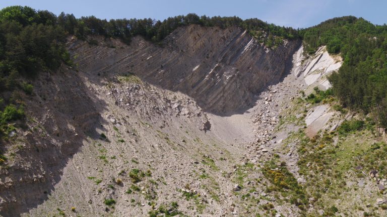
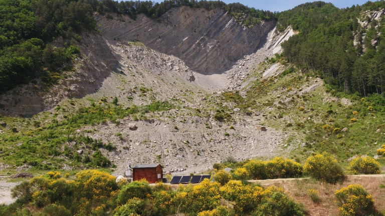
The Poggio Baldi landslide is one of the largest rock and debris landslide phenomena in the Emilia-Romagna Apennines. With an estimated volume of about 4 million cubic meters, the Poggio Baldi landslide can be considered a still active landslide. In the last century it has had two main episodes of activation known and documented, dating back to 25 March 1914 and 18 March 2010.
The first documented activation occurs on March 25th 1914 and is thought to have been caused by serious rainfall events as reported by the chronicles of the newspapers of the time: “a large area of land broke away from the top of the mountain called Val dell’Abeto and fell, dragging two farmhouses and large trees with it. This amount of land, which was pushed down into the stream below, closed off the water course [Bidente River] and formed a very large lake. One of the two houses has been completely swallowed up and there is no trace of it. The infiltration of rain in recent days was the sole cause of the landslide. The disaster does not seem to have been completed yet, since enormous boulders, almost suspended, are threatening to fall every moment” (Historical archive ‘La Stampa’, 27/3/1914).
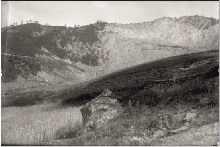
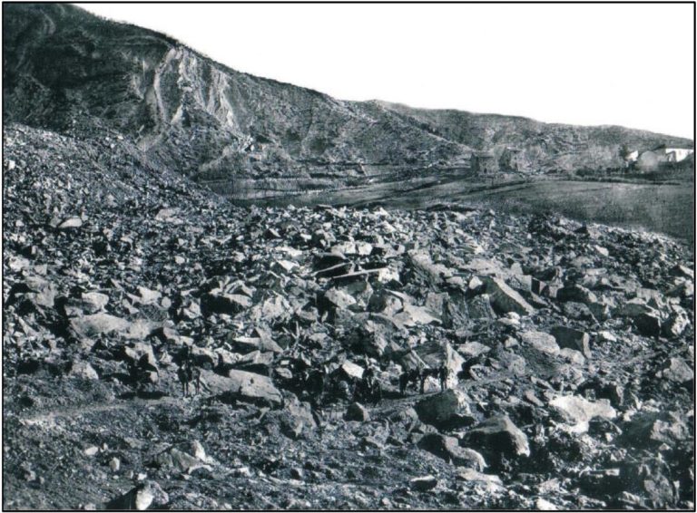
Historic photos reveal a landslide deposit composed of metric sandstone blocks and boulders and a detachment scar represented by a vertical rock scarp, similar to the one that is currently visible.
March 25th 1914, a giant rock-wedge-slide occurs at Poggio Baldi
Over the course of about one century, the wide and sub-vertical head scarp continuously released debris that accumulated on top of the landslide deposit. The overload, combined with an intense and prolonged rainfall and snow melting, triggered the landslide reactivation on March 18th 2010, causing the re-mobilization of approximately 4 million cubic meters of material.
The landslide mass, with an excessively large movement of debris, obstructed the flow of the Bidente River, causing a rise of 20 m in the water level of the river upstream and forming a barrier lake. Besides the obstructed river, the event damaged or in certain case destroyed the surrounding private houses and infrastructures.
Right after the landslide re-activation, geological site surveys have been carried out by the Department of Earth Sciences of “Sapienza” University of Rome in order to figure out the failure and its kinematics. In addition, traditional monitoring equipment (such as inclinometers, strain gauges and piezometers) has been installed along with remote sensing ones (Laser Scanner, Interferometric Radar, GNSS and drones) as an emergency response.
March 18th 2010, the mobilization of 4 Million cubic meters of rock and debris resulted in the reactivation of the 1914 paleo-landslide body
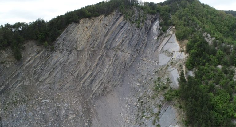
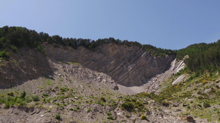
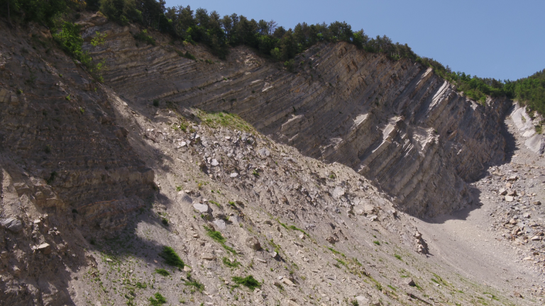
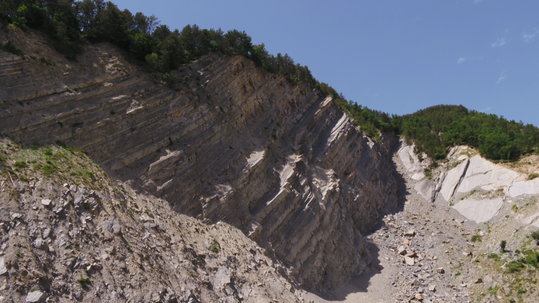
The Rock Scarp
Precedente
Successivo
Nowadays the sub-vertical rock scarp is about 100 meters high and 250 meters wide. It is characterized by recurrent rock fall events of variuous sizes ranging from a few cubic centimeters to tens of cubic meters.